One of a Kind Framed Wall Map of Paris
At the close of World War I
Quote Offer
| |
One of a Kind Framed Wall Map of Paris |
|
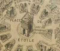
Take a birds eye tour of Paris long ago, anytime you want. And you don't need a magnifying glass!-)
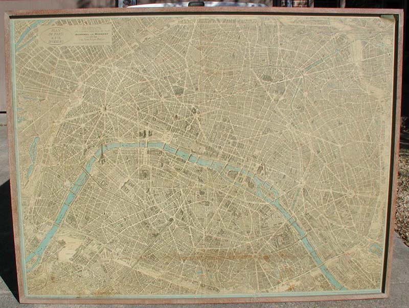
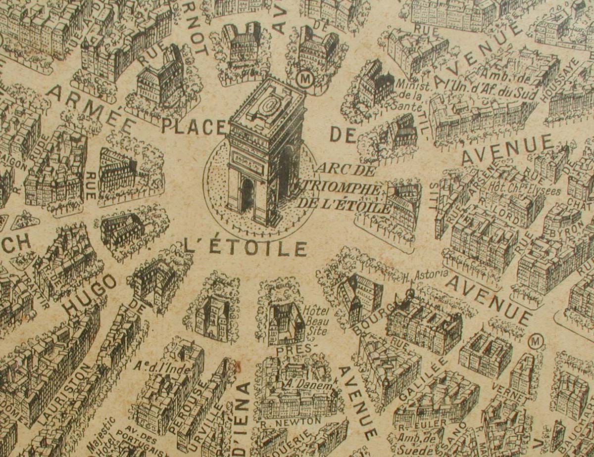
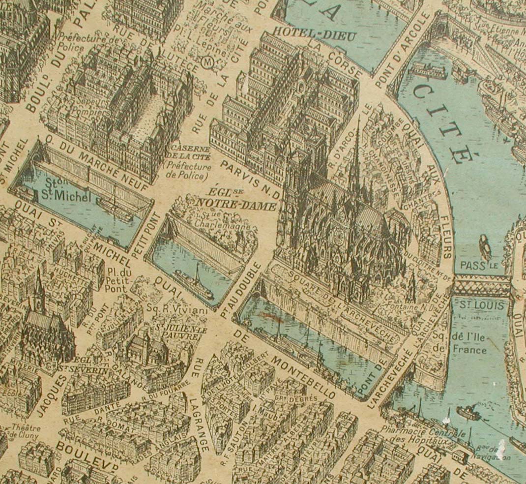
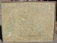
A VERY LARGE (6'-6" wide, 5' high) - 50 year old mounted map reprint (1959) of the famous "Parisian Central Department" (city center). It features artistic elevation of all streets, buildings and famous architectural monuments.
This work is perfect for an entry foyer in a fine home, or a large private library. It could compliment an engineering, architectural or urban planning firm's reception area or conference room. The map would also be perfect on a large wall of someone's elegantly furnished inner-city loft or high-rise residence.
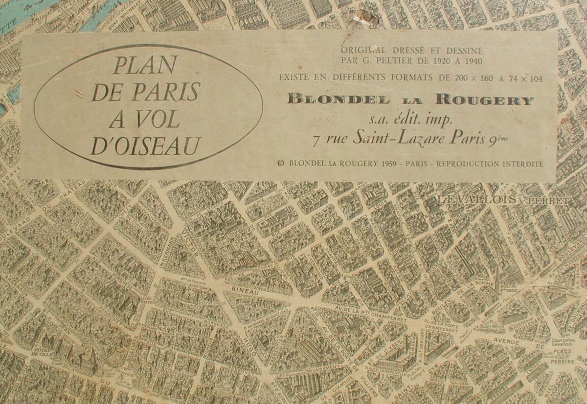
The original publisher - world renown map cartographer Dressé et Dessiné - commissioned Blondel for 200 reprints of their 1920 original rendering in 1959. Virtually all reprints were much smaller, no more than half the size of this print!! To my knowledge, this is the ONLY version this large in existence. During my research of this work, I received an email from an engineer who was born and raised in Paris. He shares some interesting thoughts on this very unique and rare artifact HERE.
This particular map was mounted in its current state, then purchased in 1960 (in Paris) by a world class architect, eventually handed down to his son. In the ensuing years it gracefully furnished his large North Dallas home until it came to me in 1997. It covered almost an entire wall of my living room and all visitors were drawn to this hypnotic piece and its fine artistic detail. The map has been very well-cared-for. But small poitions (no more than 5% of the total surface) are beginning to show discrete age-related deterioration. However, with minor restoration of these small areas, coupled with a careful spray sealing, this map can return to virtually new condition with little trouble and last for many more years. I will be happy to discuss the process.
Since removing it from my wall in 2004, the map has been carefully stored and covered by taped heavy plastic and a thick quilt. Several people whose art-related opinions I respect (including a licensed conservator) have seen the piece. All have suggested that in its present condition, it's worth significantly more than the original sale price of $500 in 1960. Many places on this map no longer exist. So this rendering is not only a fine work of art. It is a very rare historical reference. Just compare it with Google maps after looking at the pics (below).
Districts included in the map are (complete) - Louvre, Bourse, Temple, Hôtel-de-Ville, Panthéon, Luxembourg, Palais-Bourbon, Élysée, Opéra & Enclos-St-Laurent. Inner portions of Popincourt, Reuilly, Gobelins, Observatoire, Vaugirard, Passy, Monceau, Montmartre, Chaumont and Ménilmontant neighborhoods are also represented.
Please e-mail to learn more or arrange for a viewing.